
Chester Park / North Street Drainage Improvements
Town-wide drainage analysis for a historic Eastern Shore community. Drone photogrammetry and LiDAR-derived terrain feed a 2D HEC-RAS model of the town drainage network — flood extents, velocities, and hydraulic bottlenecks mapped at neighborhood scale to surface solutions compatible with the historic streetscape.
Assignment. Chester Park and the North Street corridor are older, low-lying neighborhoods on flat clay soils with shallow groundwater, where undersized drainage leaves residents with recurring street and yard flooding after ordinary storms. Under a U.S. EPA Section 319(h) grant administered by the Center for Watershed Protection, AMP was retained to diagnose the drainage system town-wide and develop a program of voluntary private-property retrofits, conveyance improvements, and conservation landscaping.
Work performed. In a single mobilization AMP surveyed several hundred inlets, pipes, culverts, and outfalls with RTK GNSS — elevations, sizes, materials, photographs, and condition — and flew the neighborhood under Part 107 with RTK ground control. The resulting Civil 3D surface supports a town-wide HEC-RAS 2D model showing where water collects. From the model, AMP developed four town-scale alternatives — swales and green infrastructure, piped conveyance, a hybrid of the two, and full curb-and-gutter with stormwater management — plus retrofit concepts for individual private lots, including rain gardens and small-lot gravel wetlands suited to clay soils.
Deliverables to date. A structure inventory and browser dashboard, in use by the Town. Progress updates to the Town and the Center for Watershed Protection. A concept plan set covering the four alternatives. The community-meeting presentation. The concepts are the basis of the implementation-phase grant application now in preparation.
Services delivered
- Drone photogrammetry survey
- LiDAR terrain model
- 2D HEC-RAS modeling of the town drainage network
- Flood-extent, velocity, and bottleneck mapping at neighborhood scale
- Phased improvement recommendations
Capture. Process. Analyze. Model.
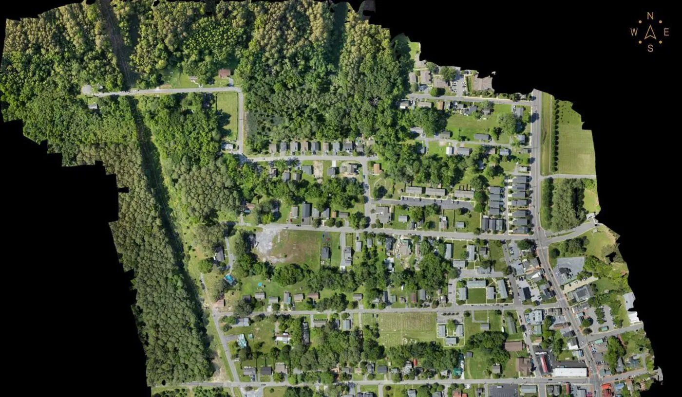
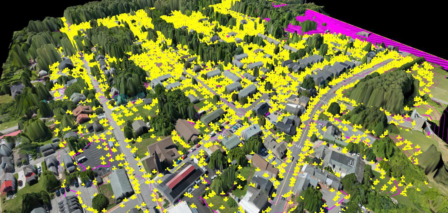
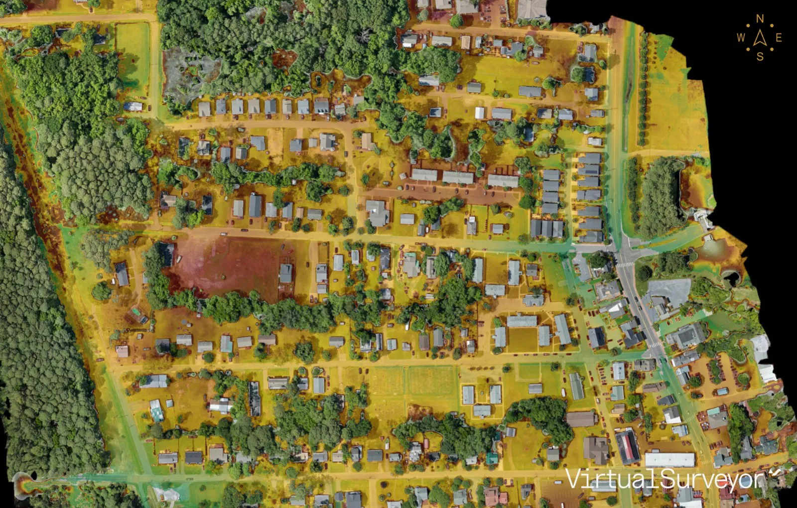
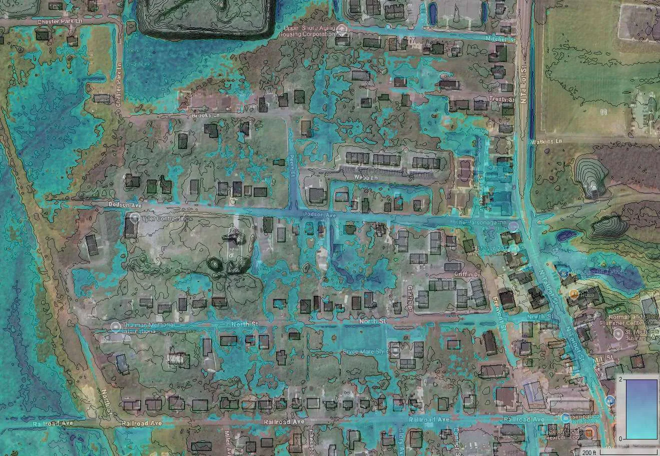
Chester Park / North Street, St. Michaels — existing conditions, 2026.
Practices modeled for the community meeting
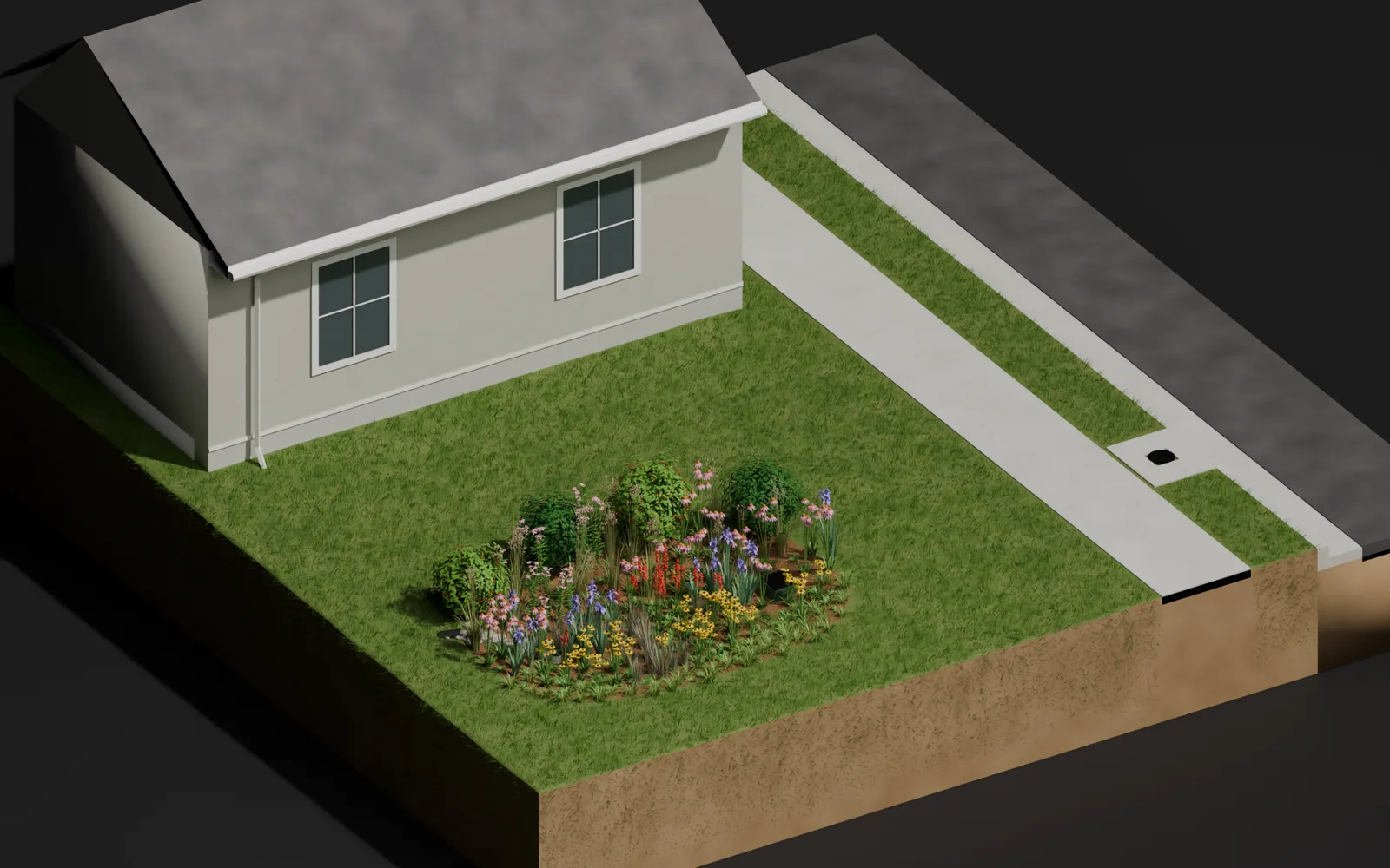
A 15 x 10 ft rain garden about 13 ft from the house: 3 in mulch, 6 in planting media, 10 in No. 57 stone and a 4 in underdrain. Water ponds up to 6 in, then overflows through a grated outlet and a pipe to the curb inlet and the public storm drain.
- Rain
- Ponding
- Soaks into the stone
- Overflow grate
- Public storm drain
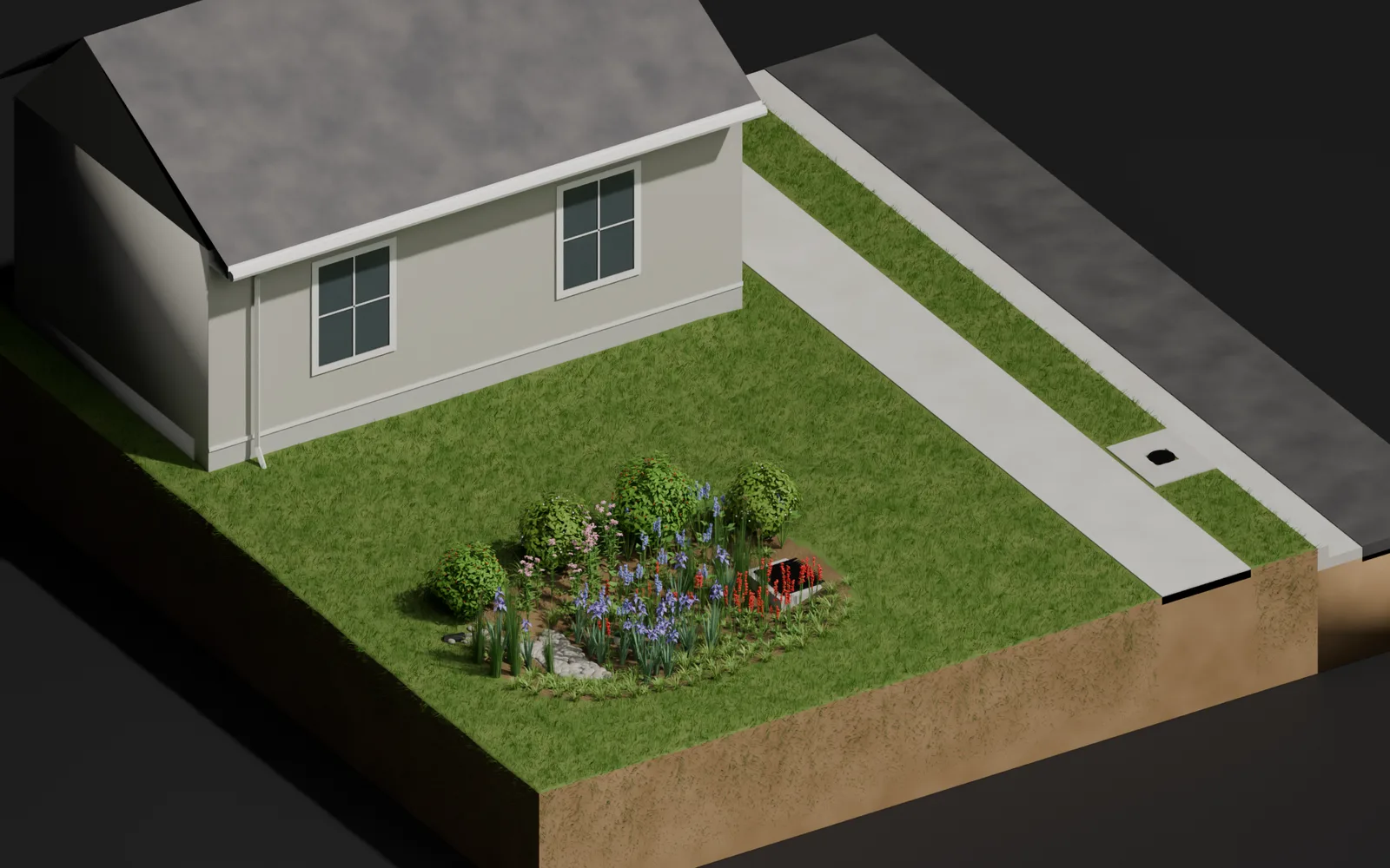
A 15 x 10 ft planted gravel wetland with no forebay. Inflow drops onto a stone strip, moves through stone that stays wet 4 in below the soil, and leaves over a J-hook inside a grated outlet, piped to the curb inlet and the public storm drain.
- Inflow
- Stone strip
- Wet stone
- J-hook outlet
- Public storm drain
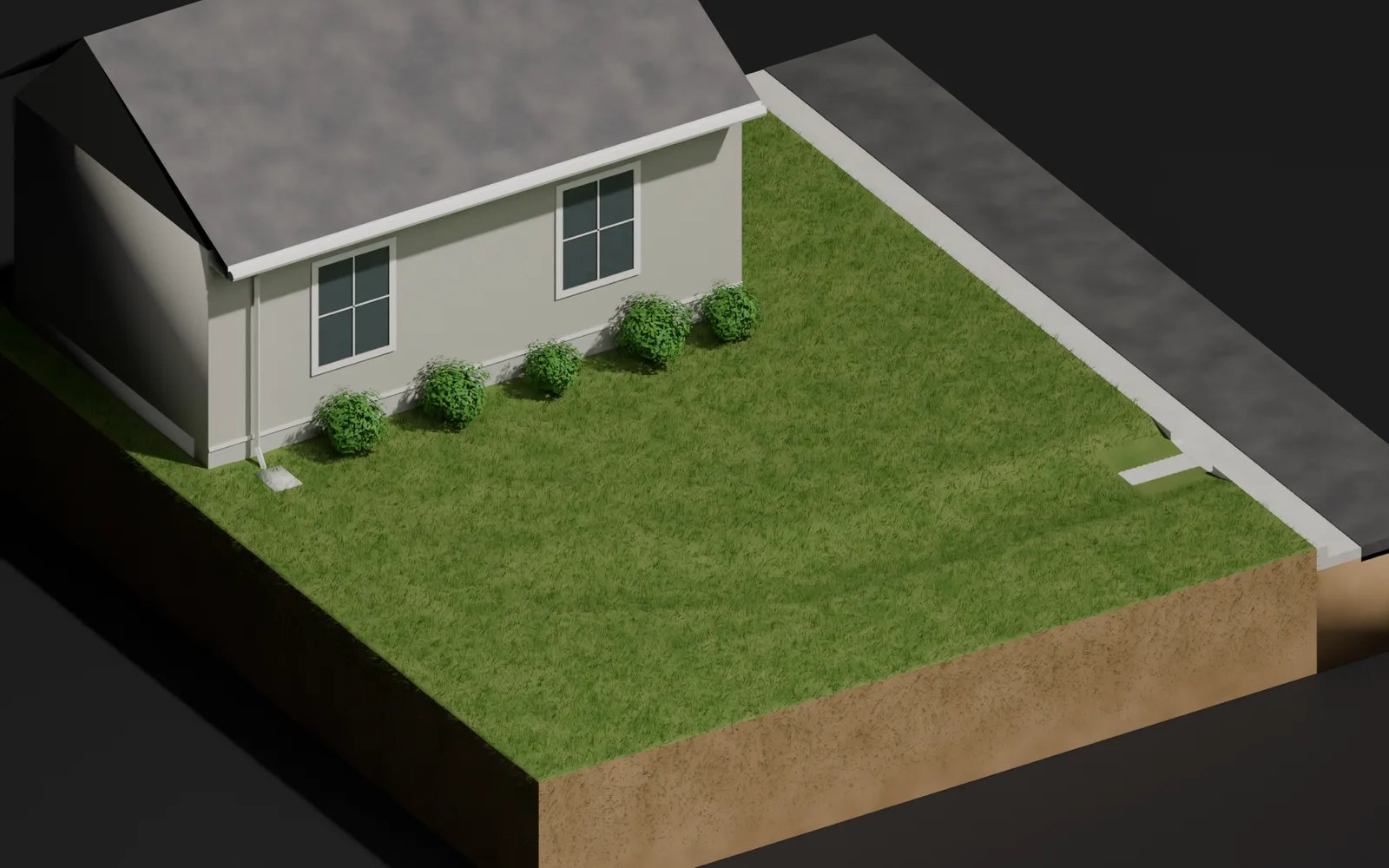
A 6 ft wide, 6 in deep grass swale from the downspout across the yard to a curb cut, where a short concrete apron carries the water through the grass strip and into the gutter. Shown without a sidewalk; a sidewalk crossing would need a covered chase under the walk.
- Downspout
- Grass swale
- Curb cut
- Gutter
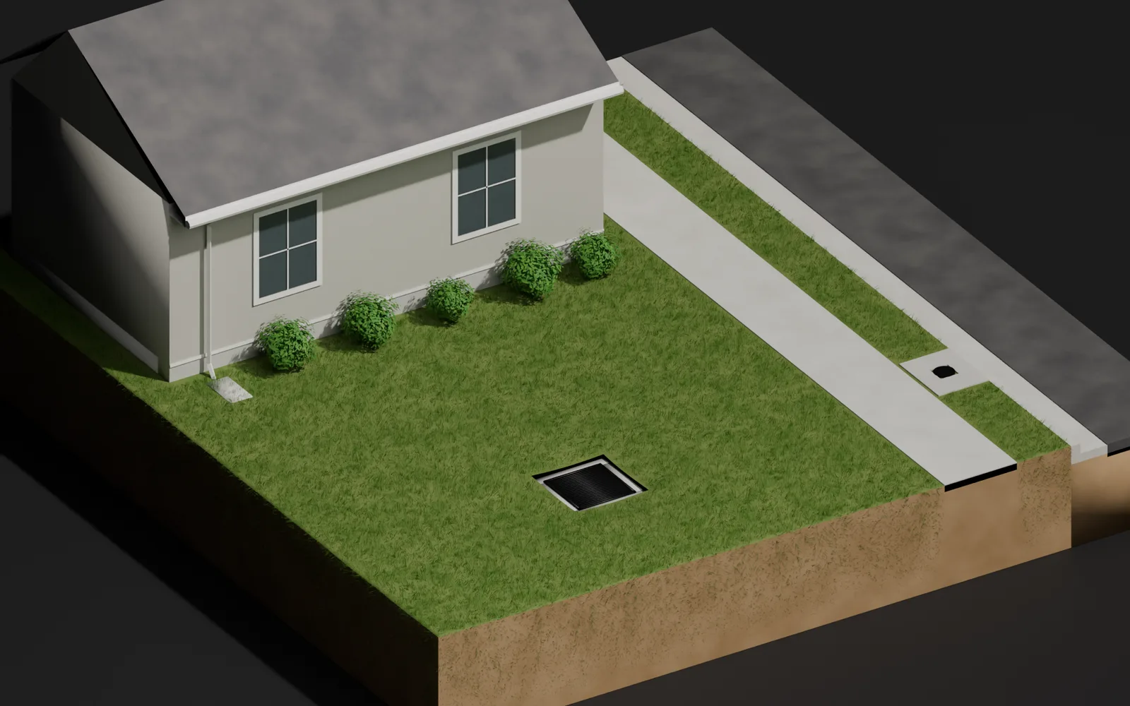
A 3 x 3 ft precast yard inlet with a cast-iron grate, set flush in a shallow dish in the lawn. Roof runoff leaves the downspout onto a splash block, sheets across the lawn with the yard runoff, and ponds briefly at the grate before dropping in. Gutter flow enters the public curb inlet.
- Roof and downspout
- Splash block
- Sheet flow across the lawn
- Yard inlet
- Public storm drain
Working under a similar jurisdictional review?
Tell us where the site sits — response within two business days from the Professional Engineer of record.
Start a project